
Search North Huntingdon Township Streets
A street directory search in North Huntingdon Township starts with a location, not a claimed roster of residents. The free Westmoreland Real Property Search can connect a road to taxable parcels and tax-record owners. Its detail screen supplies the parcel and deed references that carry the search into a recorded transaction. The county map then helps distinguish a nearby parcel from one that only shares a mailing label. Use each result as a documented step, because an owner, a former owner, an applicant, and a person who receives mail may be different people.
- Enter the road-name core in the county Location field. Omit directional prefixes, suffixes, and the street designator, then review parcels returned for the street.
- Open the parcel that matches the address. Save its map number, situs, tax-record owner, deed book and page, instrument number, and the date checked.
- Use the free county GIS map for parcel and aerial context. Compare parcel boundaries and road placement before treating two nearby results as part of the same street segment.
- Follow the deed book, page, or instrument lead into the Recorder’s DTS Deed Search. Recorded party names support a title trail, not a current occupancy claim.
- For older address context, consult newspapers, yearbooks, or historical collections under both postal locality names. The individual voter tool is not a street roster, and a voter-list export has statutory use limits.
That sequence keeps the North Huntingdon Township street directory tied to records that actually use an address. When the question becomes one person rather than one road, the separate resident lookup follows name-based court, vital, and civic channels.
North Huntingdon Township Street Directory Fields
The county’s property portal is the main current address tool for a North Huntingdon Township street directory. It is free, but it displays the current tax duplicate, which the county refreshes in late January and late June. A broad road search usually returns parcels, not people. Combine a name and location only when both are already known. Underlined result headings can sort the list, and Show Map moves a selected result into map context.
| Portal field | Format | Street-directory use |
|---|---|---|
| Parcel Number | Up to 25 characters | Use a known map number to avoid similar road names. |
| Name | Up to 45 characters | All or part of a last name, without a comma or period. |
| Location | Up to 50 characters | Use the road-name core, omitting directional words and street type. |
| Name plus Location | Combined search | Narrows an owner-name lead to a particular road. |
| Sort and Show Map | Result controls | Sort the result grid or move a selected parcel to map context. |
A result list shows a map or parcel number, owner, description, location, land use, and total assessed value. The detail record adds the situs, mailing address, deed book and page, instrument, acreage, municipality, school district, and value or tax fields. The tax table itself warns that amounts do not establish whether taxes are paid or delinquent.
Note: A tax mailing address shows where a bill goes, not proof that its recipient lives at the North Huntingdon Township situs.
North Huntingdon Township Parcel Detail
After a North Huntingdon Township property search finds the right result, the detail page adds the information needed to test it. The physical location, called the situs, should match the road and number under review. The parcel number and municipality help distinguish it from a similar street name elsewhere in Westmoreland County. Deed book and page or instrument number provide the handoff to land records. Acreage, land value, improvement value, assessed value, school district, land use, taxable status, and tax-year rows describe the tax account and property, not the people who may be present there.
Save the displayed fields as they appear and note the semiannual refresh cycle. A property owner may receive the bill at a different address, and a tax change does not itself state a move, sale closing, tax payment, or household change. The county offers separate property-card and parcel-report functions through subscription access, so a free result should be cited for only the fields actually displayed in the free system.
Map North Huntingdon Township Street Parcels
Free Westmoreland County GIS and Tax Mapping supplies parcel and aerial context for a street search. Use it after identifying a parcel in the property portal, then compare road alignment and immediately adjoining parcel lines. The inspected sources do not verify the current labels for GIS search, measurement, selection, or buffer controls, so a street directory should not claim a particular map function that has not been confirmed live. County ownership and property cards linked from GIS are subscription access, not part of the free map view.
The official North Huntingdon Township Maps page provides the road index along with ward, zoning, mining, flood, and general maps.
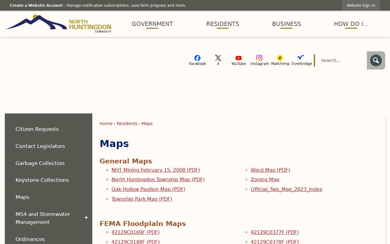
Use the road index to normalize a spelling and map cell before returning to the county parcel record. Zoning or ward context can explain a location, but neither map layer supplies a list of people on the road.
North Huntingdon Township Address Records
Each North Huntingdon Township address source answers a narrower question. The property result is the best first stop for a current parcel. The Recorder documents transactions. Township reports can tie a project to a date. Historical material supplies older leads. Keeping those boundaries visible avoids turning a street directory into a misleading resident list.
| Address source | What it can show | Access and boundary |
|---|---|---|
| County property search | Parcel, tax-record owner, situs, mailing route, assessment and deed references | Free current duplicate, refreshed twice yearly; no occupant list. |
| County GIS | Parcel position, aerial imagery, and nearby parcel context | Free base mapping; ownership-card link is subscription access. |
| Recorder deeds | Recorded parties and legal property identifiers | Online deed access begins in 1850; earlier books have archive or Recorder routes. |
| Township permit records | Address, applicant, project, category, and timing | Use Community Development, public packets, Archive Center, or a specific RTKL request. |
| Road and township maps | Official road spelling, ward, and map placement | Geographic context only, not a household record. |
| Newspapers and yearbooks | Dated historic name or address mentions | In-person source evaluation is needed; no address listing is promised. |
Township materials belong with the Township. County deeds, court files, elections information, and vital records have different custodians. A specific Township RTKL request should state the address, date window, and record type; Pennsylvania’s Right-to-Know Law generally provides a five-business-day response period.
Trace North Huntingdon Township Deeds
Property search detail turns a North Huntingdon Township street directory result into a land-record lead through its deed book, page, or instrument number. Start with that reference in the Recorder’s DTS entry point. The current recorded transaction identifies party roles, and a prior seller can then be searched as a grantee in an earlier conveyance. Keep the parcel number, lot or plan terms, legal description, book and page together, since a street number is only a convenience label in a title search.
Westmoreland states that its online deed search reaches from 1850. Earlier deeds are not a reason to stop: the State Archives guide identifies Westmoreland deed books on microfilm from 1773 through 1897, and the Recorder’s research access is the practical fallback. A later deed’s mailing address can provide a lead, but does not establish a party’s present residence.
North Huntingdon Township Permit Addresses
Community Development records add a date layer that tax and deed records do not. The Township’s zoning materials use a project address and may include owner, contractor, parcel tax ID, ward, zoning class, and project details. Public monthly permit reports have shown permit number, ward, type, category, contractor, applicant, property address, and estimated cost. They are useful for checking that a named party was connected to a project at an address on a certain date.
No live public permit-lookup search was verified. Use the application, a public meeting packet, the Township Archive Center, Community Development, or a narrowly written RTKL request. Do not treat a contractor, applicant, trust, or agent on a permit as a person living at the site.
North Huntingdon Township Street History
North Huntingdon’s January 1, 1974 address rule matters when an older street directory search goes cold. The Township required residents who used “Irwin, PA 15642” to use “North Huntingdon, PA 15642,” while retaining ZIP 15642. Older newspapers, permits, directories, voter material, and legal descriptions can therefore use the historic Irwin form for a parcel that later county records label North Huntingdon.
Search both locality labels for older material, confirm the road against the official map, then rely on the parcel and legal description to resolve the match. North Huntingdon’s road index gives alphabetic road names and map-grid references, while the Maps page provides ward, zoning, mining, flood, and general-map context. A recorded parcel reference remains the durable tie between the historic and current address forms. Check the record date before treating either postal name as current. This is a records-geography issue, not proof that the postal label determines the municipality.
North Huntingdon Township Street Voter Limits
Pennsylvania’s public Check My Voter Registration service is an individual status tool. It does not provide an official way to browse everyone on a North Huntingdon Township street. State guidance also directs users to their county voter-registration office or 1-877-VOTESPA for voter-status help. A no-result is not proof that a person has never lived on a road, and an old civic record is not a present-address guarantee.
A fuller Public Information List can contain registration-related fields, but access is subject to Election Code rules. The Department requires identification and a written permitted-use certification for list inspection or copying. The records do not reveal ballot choices, and protected Address Confidentiality Program information must remain protected. That controlled route is not permission to make a neighborhood contact list or use public street data to pressure people.
North Huntingdon Township Street Terms
Address records use terms that look similar but point to different evidence. Reading them carefully keeps a North Huntingdon Township street directory result within the limits of the record.
- Parcel
- A tax-map unit of land identified by a map or parcel number. It is a property key, not a list of people.
- Situs address
- The physical property location recorded for the parcel. It can differ from the address used to mail the tax bill.
- Plat or plan
- A recorded subdivision or survey reference that helps identify land when an address changes or repeats.
- Criss-cross directory
- A historic directory arranged by address rather than name. No verified local criss-cross collection was found, so library and archive holdings need direct confirmation.
North Huntingdon Township Street Limits
A street directory cannot reveal everyone who lives at an address. County property data does not list unrecorded occupants, delivery recipients, utility customers, driver-license holders, guests, children, or protected residents. Pennsylvania’s individual voter status tool verifies an individual’s registration status; it is not a street-browse tool. A fuller public voter list is controlled by Election Code identification, certification, and permitted-use rules, and it never discloses ballot selections.
Some addresses are deliberately protected. The Pennsylvania Address Confidentiality Program supplies an eligible participant with a substitute address for listed records. A missing or substitute address is not an invitation to search around the protection. Use a street-by-street record trail for personal, lawful research and verify important facts with the custodian.
Lawful use. North Huntingdon Township address records are not a reason to contact, watch, stalk, harass, or harm another person. Keep research tied to a legitimate personal, property, family-history, or civic question.